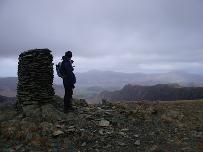
Friday, 16 February 2007

Day 5

After having a day off in order for the blisters to heal themselves, we decided to do something a little less taxing today. Therefore we made the decision to do the smaller fells around Skiddaw: Carl Side, Long Side and Ullock Pike; they were, after all, blighting my northern range checklist.

The day was grey but not quite raining as we set off, saying goodbye to one of the earliest completers of the Wainwrights, our Uncle. A slow drive along the A66 took us to Millbeck, under Skiddaw, where we dutifully placed our money in the honesty box and set off.

It was a steep but rewarding climb up the front of Carl Side (2420 ft) from where we had fantastic views of Keswick until we hit the clouds at about 2000 ft. We reached the summit in good time.

We then made our way along the ridge to Long Side (2405 ft) where we were enormously excited to see a buzzard and some lovely views as the clouds lifted further. The climb to the summit seemed unfairly simple after the last few days.

We then had an easy time getting onto the summit of Ullock Pike (2230 ft) from where we turned around and headed straight back again.

At Carl Side tarn we had to make the decision whether we would go on to do Skiddaw or not; I decided that we wouldn't as I wanted a cup of tea and slice of cake at the Strawberry tea-shop in Keswick. Best decision ever made. As we headed down we decided to stop at a halfway point so that we could eat our lunch. We sat down, looked at each other and realised that we hadn't packed our lunch. Oops.

We headed down at a surprising rate and had a lovely lunch in Keswick and a fantastic afternoon strolling around.

Total distance: 6 miles and 2750 feet of ascent.

New fells: Carl Side, Long Side and Ullock Pike.

Wednesday, 14 February 2007

Day 4

Contrary to what the weatherman said, the weather was perfect for walking today: blue skies, glorious sunshine and a fresh chill in the air. Therefore, big things were planned: Bowscale Fell onto Bannerdale Crags, then down to Mungrisdale Common, up to Blencathra and back down over Souther Fell. Perfect.

We set off with an aged parent to Mungrisdale where we parked up and dutifully put a pound in the honesty box. It was then a very straightforward climb up the side of Bowscale Fell and right onto the summit (2306 ft). The weather was fab and, although it wasn't the fastest ascent in the world, we made it up to the top in good time.

It was then just a case of following a wide green path over to Bannerdale Crags. Or was it? About half way across one member of the team began to realise that the blister plasters on her feet weren't doing a very good job and so decided that at the top of Bannerdale Crags she would change the plasters. No problem. She realised the difficulty of her task when she remembered that she had left them on the bathroom shelf back at the guest house. By the time that we had reached the summit (2230 ft) it was becoming clear that there was no chance of her going on to do the bigger and further away fells. Much debate followed and we decided that we would all stick together and head back down over Souther Fell.

A cowboy-Roy style descent down the back of Bannerdale Crags became much more fun when it was discovered that it could be done using the old-age style of sitting down and lifting up the feet. What would have been a very painful and slow descent quickly became an enormous amount of fun. Therefore we reached the River Glenderamackin in no time at all and made a fairly quick ascent onto Souther Fell (1680 ft).

It was very cold on the top so we headed down towards Mungrisdale and had our lunch on the brow of the fell. It was then a quick ascent down into Mungrisdale which was only made longer by the fact that we had to take a seemingly unnecessary detour around a field.

We arrived back at the car, slightly disappointed.

Total distance: Approximately 5 miles and 2000 feet of ascent.

New Fells: Souther Fell

Tuesday, 13 February 2007

Day 3

After day 2 was given up to admin tasks and a compulsory visit to the Jennings brewery to pick up a case of Cockahoop, the team decided that day 3 needed to be impressive.

Another early start meant that we were parked near Newlands Church and ready to walk up the mighty Robinson by 10.15. A gentle stroll along Scope Beck took us up to the reservoir which was calm and peaceful - naturally it couldn't last. As we followed the path we felt as though we should be heading more 'up' and so decided to take a cowboy-Roy route up the side of Robinson. A tough climb allowed us to join the High Snab Bank path from where it was a thrilling climb onto the summit of Robinson (2417 ft).

We then followed the direct route up onto Hindscarth (2385 ft) where, the weather being very kind, the clouds lifted to about 3000 ft meaning that we had tremendous views of the fells in Butteremere and even over to Wasdale.
As well as being a lovely walk, this was also a chance for the fell-running member to make a reconnaisance of the final leg of the Bob Graham round, although it was being followed backwards.

A walk over to Dale Head (2473 ft) was interrupted by lunch in a dell which protected us nicely from a bitingly cold wind. It was at this point that we noticed that the fells had begun to become increasingly busy; whereas before we had been just about the only people around, we were now surrounded by groups of enthusiastic walkers.
This became even more noticeable as we headed down to Dale Head tarn and onto High Spy (2143 ft). The 550 ft climb up the back of High Spy was fairly painful but completed with a focused and enthusiastic approach.

It was then just a case of covering the 3 miles over Maiden Moor (1887 ft) and Catbells (1481 ft) in order to complete the planned walk. This was done with one of the party feeling it in their legs whilst the other member seemed to be having no trouble whatsoever. However, the views made up for any discomfort, both down over Catbells and back up to the fells where we could see just about everything that we had climbed.


All we had to do then was to retrace our steps slightly and then head down Yewthwaite Gill in order to reach the car. This was delayed slightly by a hot squash and biscuit stop.
Total distance: 12 miles and 3810 ft of ascent.
New fells: Robinson, Hindscarth and Dale Head.

Sunday, 11 February 2007

Day One

Due to the cricket, the team were up very early this morning and ready to walk with packed-lunch, water-proof gear and various navigational tools by 9.00. The weather forecast was fairly depressing and a drive through the Lakes yesterday had shown there to be a lot of snow on the hills. Therefore, a plan was formed to include smaller fells than had been previously planned.

A drizzly drive to Orthwaite did little to dampen our spirits and we set off along Horsemoor Hills farm road at approximately 10.30. A stroll along a bridleway quickly took us up Great Cockup (1720 ft) (you in the back row, stop giggling!) and into the cloud.

Undaunted, we took a quick picture and headed down to Trusmadoor and then up to Meal Fell (1770 ft). Walking down to the col there were some intimidating views and our perspective was surprisingly affected by the snow on the mountains ahead. However, the climb up to the summit was not nearly as hard as it had looked from the bottom.

Another picture was taken and then there was a long slog up onto Great Sca Fell (2131 ft). The steepness of the ascent and the thick cover of snow over the 'path' made this slightly taxing on the calves but we pushed on without stopping for breath. We were chuffed to see that we had reached the summit by 12.05.

By this time it was clear that the weather man had lied when he had said that the wind-chill would be 'insignificant': it was freezing! Therefore, there was no time for a break, instead we made a beeline for Knott (2329 ft).

Again, this seemed to take us a lot less time than expected and we decided that we had plenty of time left to go on to Great Calva (2265 ft). As there was still no sign of the cloud lifting we had to use the compass in order to determine the correct direction and, miraculously, we were spot on. We followed a fence up to the top and were once again a bit troubled by thick snow on the path on the way to the summit.

My brand new walking pole was put to great use on the way down as we were freezing and wanted to get down as quickly as possible. We picked up the path down Hause Gill which proved to be a bit tricky to begin with but we were soon making good time down past Burn Tod. We finally ate our sandwiches by a lovely little stream and washed them down with some tasty hot squash and then worked them off by making a good pace down to the car. We were back there by 2.40.

Total distance of 9.75 miles and 2460 feet of ascent.

New Fells: Great Cockup, Meal Fell and Great Calva.